- Recorded
- 25 July 2026
- Quarter
- Inner loop, north
- Air
- 97 F at the start
- Sky
- White haze, dead still
- On foot
- 1.1 miles, about 1 hour 5
Record 06
Twenty piers, two halves, and the most valuable shade in this record
An elevated road took the middle of this block in the nineteen eighties. In July, the space it left underneath is the only comfortable ground for a quarter of a mile.
Nineteen parcels, four of them severed by the structure and two of them reduced to slivers that nothing can be built on. The longest walk in the run and the hottest.
The structure crosses the block diagonally, which is worse than crossing it square, because a diagonal takes a corner off four parcels instead of a strip off two. It stands on twenty piers in two rows, about sixty feet apart, and the deck is high enough that the noise arrives as a wash rather than as individual vehicles.
Underneath is a strip of ground about sixty feet wide and the length of the block: unbuildable, unshaded from the side, and completely shaded from above.
What stands here
North of the structure: a self storage building, a bail bond office that was closed, two houses and a fenced lot with three trailers. South: a tyre shop, a small church, four houses, and a corner store with a hand painted board.
Under the structure: a gravel lot used for parking, a stack of highway barriers belonging to the road authority, and the best shade on the block.
The shade, in July
At ninety seven degrees with a white sky, the difference under the deck was worth measuring rather than describing. It is perhaps ten degrees cooler in the shade and, more to the point, it is out of the direct sun entirely, which in this climate is a different category of comfort rather than a matter of degrees.
Three cars were parked under it at nine in the morning on a weekday, none of them belonging to anybody visible. Two men were standing beside a truck talking, which is the only time in this record that anybody appears, and they are unidentifiable and not photographed.
Everything about this block in summer is decided by the deck. In February the same ground is the least pleasant part of the walk: cold, damp and dark.
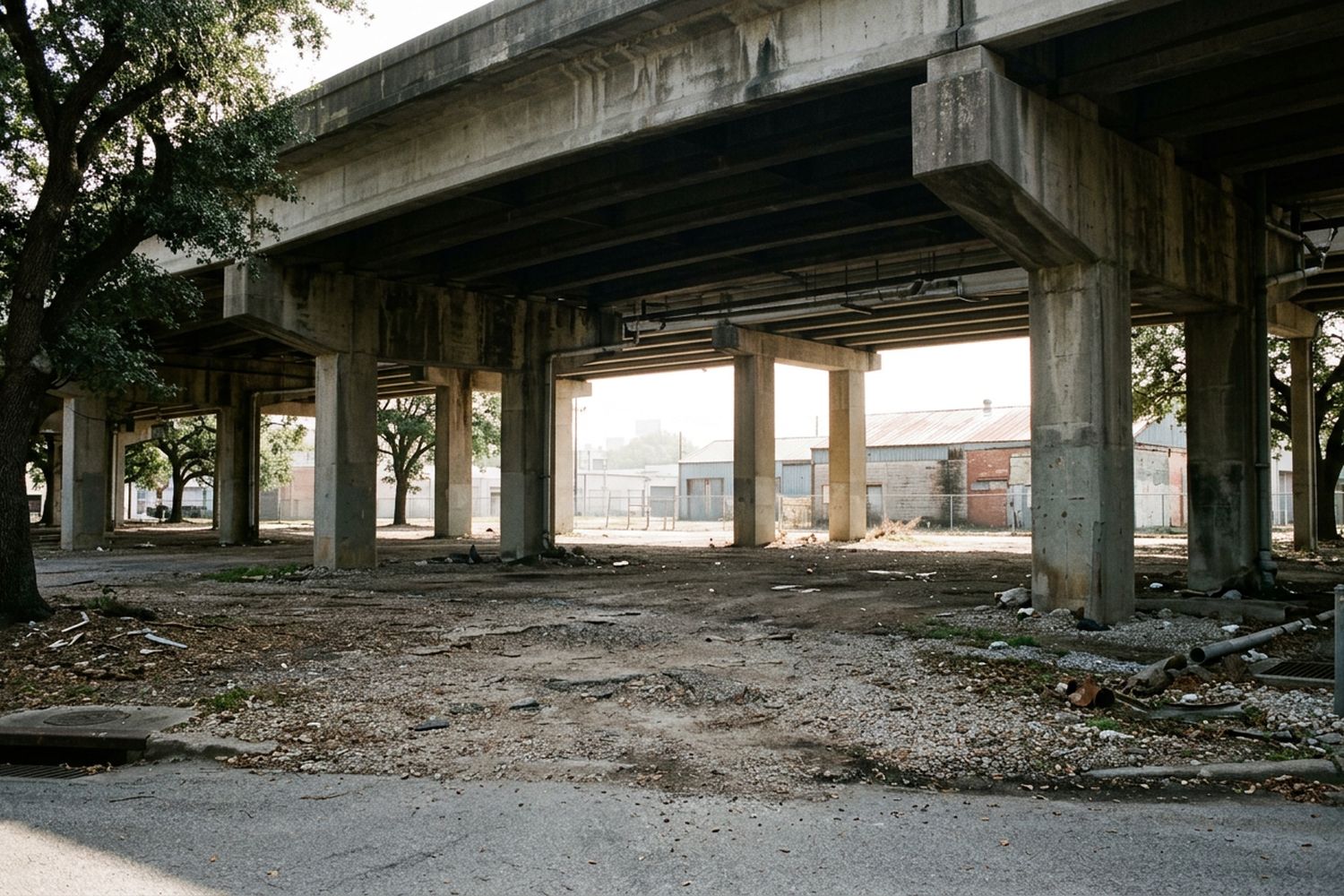
What the arrangement produces
- Two halves that stopped resembling each other. The north half went commercial within a decade of the structure going up. The south half stayed residential and still is.
- A parking economy with no owner. The gravel under the deck is used constantly and belongs to nobody who is present.
- Sliver parcels, two of them, about eleven feet wide, mown by somebody and built on by nobody.
- A wind that only exists here. The gap between the pier rows moves air on days when nothing else does. It is the reason people stand under it rather than merely park.
- Noise that becomes weather. Forty years in, it is not a sound the block reacts to. It is a condition, like the humidity.
Walking it
Pavement on three sides and none on the fourth. Under the structure the surface is gravel and broken concrete with a drainage channel to step over. Two crossings, one signalled, and the signalled one is the only one worth using.
One and one tenth miles with the return, an hour and five minutes, started at eight in the morning and finished before the heat made the pavement sections unwise.
What it tells you
That the largest single decision affecting any block in this record was made by a highway department in another decade, and it is the one decision that had nothing to do with zoning either way.
A city without a land use map still has a map. It is drawn by the road department, and it is the only one that cannot be argued with lot by lot.